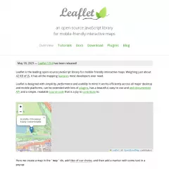
Leaflet is an open-source JavaScript library for interactive web mapping. It provides a lightweight and flexible solution for displaying and interacting with maps on websites. Leaflet is designed to be easy to use, customizable, and compatible with various mapping providers and technologies.
Here are some key features and capabilities of Leaflet:
Map Display: Leaflet allows you to display maps on your website with zooming, panning, and tile-based rendering. It supports different map tile providers, including OpenStreetMap, Mapbox, and custom tilesets, allowing you to choose the map source that suits your needs.
Markers and Popups: You can add markers and popups to the map to indicate specific locations or points of interest. Markers can be customized with icons and labels, while popups provide additional information or interactions when users click on the markers.
Layers and Overlays: Leaflet supports multiple layers and overlays on the map. You can display different layers, such as base maps, overlays, and geoJSON data, allowing you to overlay additional information on top of the base map.
Interactive Features: Leaflet provides various interactive features, such as zoom controls, scale controls, and user interactions like dragging, scrolling, and double-clicking on the map. It also supports touch events for mobile devices, ensuring a responsive and user-friendly experience.
Geolocation: Leaflet includes built-in geolocation functionality, allowing you to retrieve and display the user's current location on the map. This feature is especially useful for applications that require location-based services.
Plugin Ecosystem: Leaflet has a vibrant plugin ecosystem that extends its functionality. There are numerous plugins available for additional features, such as clustering markers, drawing shapes, routing, heatmaps, and more. These plugins can enhance the capabilities of Leaflet and provide additional customization options.
Customization and Styling: Leaflet allows you to customize the appearance and style of the map and its components. You can define custom map styles, add overlays, apply CSS styles to map elements, and control the map's behavior and interactions through configuration options.
Leaflet is widely used in web development projects that involve mapping and geospatial data visualization. It provides a simple and flexible framework for creating interactive and visually appealing maps on websites. Whether you're building a location-based application, a travel website, or a data visualization project, Leaflet offers the tools and capabilities to bring your maps to life.
Leaflet has extensive documentation, tutorials, and examples available on its official website, making it easier to get started and explore its features. Additionally, there is an active community of developers who contribute to the project and provide support through forums and other resources.
Top Websites using Leaflet
- Bounce ratePages / VisitVisit duration
- 1windy.com
Windy: Wind map & weather forecast
Weather radar, wind and waves forecast for kiters, surfers, paragliders, pilots, sailors and anyone else. Worldwide animated weather map, with easy to use layers and precise spot forecast. METAR, TAF and NOTAMs for any airport in the World. SYNOP codes from weather stations and buoys. Forecast models ECMWF, GFS, NAM and NEMS - 17.85 14.52 03:12
- 2mvcc.vic.gov.au
Home | Moonee Valley City Council
Description - n/a 3.22 n/a
- 3earthquakemusic.netlify.app
Earthquake music
Earthquake Music - 60.92 3.25 10:47
- 4vibrant-perlman-43d7a4.netlify.app
Example - 60.92 3.25 10:47
- 5jlaw.netlify.app
JLaw's R Blog
A Data Science Site for ***ysis and Whatnots by JLaw - 60.92 3.25 10:47
- 6androgear.netlify.app
- 60.92 3.25 10:47
- 7deepthought-theme.netlify.app
DeepThought - 60.92 3.25 10:47
- 8wsx-c19-mobile.netlify.app
West Sus*** COVID-19 Data dashboard - 58.42 3.28 10:04
- 9santavitoria.rs.gov.br
Página Inicial - Prefeitura Muni***l de Santa Vitória do Palmar - 43.28 6.07 13:37
- 10apexlegendsstatus.com
Current Apex Legends status | Origin and EA status
Get current server status for Apex Legends, Origin and EA worldwide on PC, PS4, Xbox and Nintendo Switch. Updated every minutes, graphs, heatmap... everything you need to know if Apex, Origin or EA is down ! - 32.01 14.07 49:27
- 11rubmaps.ch
*** massage parlor reviews - find your Happy Ending!
l► Internet's #1 massage parlor review site offering high quality honest AMP reviews, written by real users. Signup and get access to newest reviews. - 21.38 7.03 09:32
- 12deepstatemap.live
DeepStateMAP | Мапа війни в Україні
Новини війни росії проти України на мапі - 41.16 16.98 02:19
- 13educabest.com
Education news.Education best value!
Education news.Education best value! - n/a 10.20 n/a
- 14independent-publishing.com
Aperçu OSM GéoPicardie - n/a 24.00 n/a
- 15lidl.de
Lidl lohnt sich - Lokal bei Dir vor Ort und Online
Entdecke unsere groÃe Produktvielfalt mit unschlagbaren Preisen ⺠Wöchentliche Schnäppchen-Aktionen â Online und auch lokal vor Ort - 35.42 6.27 03:17
- 16satellites.pro
Just a moment...
🗺️ all world countries satellite map with labels, ruler, places sharing, search, locating, route planning, states boundary tracking, city list menu for each state, weather forecast - 34.26 30.54 03:00
- 17gamerpro.it
- n/a 60.00 n/a
- 18ocbccards.com.my
OCBC Bank Cards and Loans | Singapore Family Online
OCBC Bank is one of the major banks from Singapore. It stands for Oversea-Chinese Banking Corporation Limited and is among the oldest banks in the country. The - n/a 13.94 n/a
- 19sondelazone.fr
- n/a 31.00 n/a
- 20whangamata.school.nz
IIS7 - n/a 4.00 n/a
- 21lidl.fr
Lidl, le vrai prix des bonnes choses. En supermarché et en ligne.
Profitez d'offres exceptionnelles sur un large choix de produits à retrouver en supermarché et en ligne. - 24.46 11.15 02:05
- 22effiesvarietystore.com
- n/a 39.00 n/a
- 23carmudi.com.mx
El mejor mercado de autos en México. Venta de carros nuevos y usados
Encuentra los mejores autos nuevos y usados en venta en México. Mercado online para comprar y vender coches, motos y camiones nuevos, de segunda mano y seminuevos. - n/a 32.00 n/a
- 24milelevillas.com
- n/a 42.00 n/a
- 25enfuegocantina.com
En Fuego Cantina
En Fuego Cantina - Del Mar's best mexican restaurant serving coastal cuisine - n/a 2.92 n/a
- 26jobsradar.com
JobsRadar.com - Find Jobs. Showcase Your Resume. Get Hired.
Find your next job here. Search for jobs. Manage and host your resume. Compare salaries. Research careers and advance your education. - n/a 3.92 n/a
- 27archeagedatabase.net
Archeage Database 1.2
Archeage Database 1.2 - n/a 4.31 n/a
- 28topcsjobs.com
Top Customer Success Jobs
Are you looking for a job in Customer Success? topCSjobs.com is the #1 job board for Customer Success. Find your next opportunity now! - 5.35 61.01 05:53
- 29marcos.com
Order Delicious Pizza Online | Marco's Pizza
Marcos Pizza offers authentic Italian pies with fresh ingredients and bold flavors. Order online or find a location near you for a delicious pizza experience. - 39.02 4.61 05:40
- 30powersportclassifieds.com
- n/a 32.00 n/a
- 31mydestination.com
Your Local Travel Guide to Worldwide Destinations - My Destination
Find all the information you need with our travel guides, tips and articles for destinations worldwide. Plan your trip with My Destination today. - n/a 3.49 n/a
- 32stannestemora.nsw.edu.au
St Anne's Catholic College | Catholic K-12 School in Temora, NSW
A welcoming Catholic school in Temora, NSW. Enrolling now for Kindergarten to Year 12. Discover quality education in a caring community. - 37.40 4.18 07:21
- 33catchfood.com
CatchFood
CatchFood. is a web commerce platform for ordering and delivering take-out & Dine In, Coupons and More. Based in Minnesota. Was founded in 2015. We offer our services through desktops and mobile apps for iPhone, Android, Ipad.
Get Food Delivered, Pick-Up & Dine in From Your Favorite Restaurants. Browse the best delivery menus, coupons, ratings & reviews, and more. Step By Step Recipes Delivered To Your Door. Order Today! - 100.00 38.00 n/a
- 34lidl.co.uk
Food, Non-food, Wine and Recipes | Lidl GB
Explore our range of high quality fresh food & product offers. Enjoy great prices & latest deals in store. Shop today & collect your Lidl Plus points. - 39.85 3.99 02:15
- 35univie.ac.at
Universität Wien – Studieren, Forschen, Leben in Wien
Die Universität Wien ist mit über 90.000 Studierenden eine der größten Hochschulen Europas. Entdecken Sie unser vielfältiges Studienangebot, exzellente Forschung und das Unileben im Herzen Wiens. - 30.74 8.08 06:30
- 36aromaemagia.com.br
- n/a 84.00 n/a
- 37nevadabeerquest.com
Welcome Home - Nevada Beer Quest
Nevada Beer Quest - Nevada’s Only Printed & Digital Interactive Brewspaper for Craft Beer Peeps. Tap into NBQ for Featured Articles, Brew Hoppenings, Craft Beers and more. - n/a 29.00 n/a
- 38flightconnections.com
403 Forbidden
Direct flights from more than 900 airlines on an interactive flight map. Search, find and compare any flight path or airline route with our flight maps! - 33.11 6.26 03:16
- 39newlife.id.au
Newlife » Home
Helping people to find God and live the new life that Jesus offers. Resources include articles on Christian living and Biblical equality. - n/a 28.00 n/a
- 40mcprohosting.com
Minecraft Server Hosting for $2.50 | MCProHosting
MCProHosting is a provider of premium Minecraft server hosting for less. Offering cheap Minecraft hosting from $2.50! The best service available for the cost. - n/a 8.60 n/a
- 41zavvi.nl
- n/a 20.00 n/a
- 42guidempl2.web.app
Welcome to Firebase Hosting - n/a 1.00 n/a
- 43jetu.cr
- n/a 52.00 n/a
- 44raccourci.fr
- n/a 21.00 n/a
- 45livingonloveandcents.com
- n/a 3.30 n/a
- 46paxcw.com
- n/a 26.00 n/a
- 47b3thrh-7.com
- n/a 55.00 n/a
- 48i-trekkings.net
I-Trekkings, blog randonnée, outdoor itinérant et micro-aventure
I-Trekkings, blog randonnée, outdoor itinérant et micro-aventure: rando, trek, vélo, kayak, ski de rando... Récits avec traces GPS, tests de matériel, conseils - 49.48 2.48 02:43
- 49e-alestra.com
- n/a 99.99 n/a
- 50homebase.co.uk
Just a moment...
Read our step-by-step guide on how to quickly and easily remove and silicone sealant from your bathroom or kitchen. - 62.44 3.07 01:48